Cai Rang Floating Market
Cai Rang Floating Market, located along the Hau River, is a renowned landmark in Can Tho. Situated about 6 kilometers southwest of the city center, this market offers a vibrant glimpse into the unique river-based lifestyle of the Mekong Delta people.
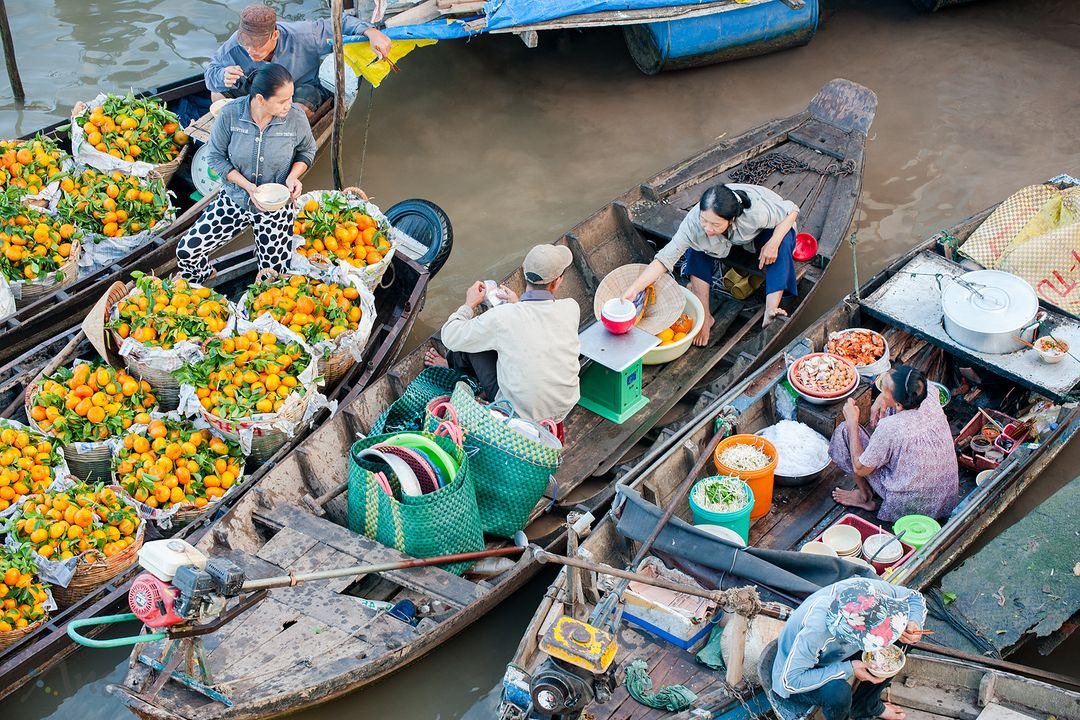
With its strategic position at the confluence of several waterways, including the Hau River and Can Tho River, the market serves as a vital trading hub for locals and a fascinating attraction for tourists. Vendors aboard rustic wooden boats sell a variety of goods, including fresh fruits, vegetables, and local delicacies, creating a bustling and colorful scene that captures the essence of the region’s commerce and culture.
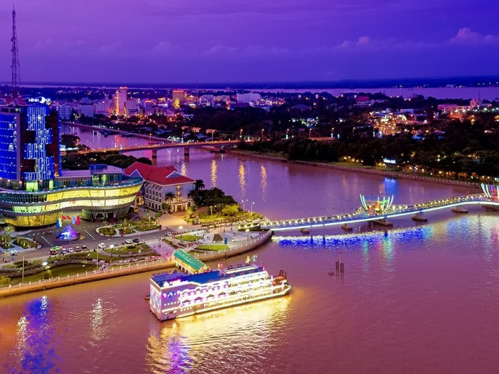
Ninh Kieu Wharf
Ninh Kieu Wharf, just 2 kilometers from the city center, holds a special place in Can Tho’s identity, often celebrated in poetry. Visitors can enjoy boat rides on the Hau River, dine at floating restaurants, and relax in the scenic park area, offering a perfect blend of tranquility and cultural immersion.
My Khanh Tourism Village
My Khanh Tourism Village, around 10 kilometers southeast of Can Tho City, entices travelers with its fruit orchards and diverse entertainment. From exploring the 18-level hell to enjoying circus performances, visitors of all ages can partake in engaging activities. The village’s outdoor swimming pool and bumper cars promise a delightful experience amidst the charm of the Mekong Delta.

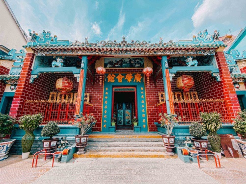
Ong Pagoda
Ong Pagoda, nestled in the city center, just 1 kilometer from Ninh Kieu Wharf, exudes serenity and spirituality. With its distinctive Chinese architecture, it serves as a sanctuary for worship and contemplation, hosting significant festivals like the Vu Lan Festival.
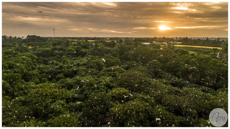
Bang Lang Stork Garden
Bang Lang Stork Garden, situated in the tranquil Thot Not District, lies approximately 60 kilometers southeast of Can Tho City. As one of the largest stork sanctuaries in the Mekong Delta, the garden boasts a breathtaking riverside landscape teeming with thousands of majestic white storks. Visitors can marvel at the sight of these graceful birds returning to their nests during sunrise and sunset, creating a mesmerizing spectacle against the backdrop of the verdant countryside. With its serene ambiance and abundant wildlife, Bang Lang Stork Garden offers a peaceful retreat for nature lovers and photography enthusiasts alike.
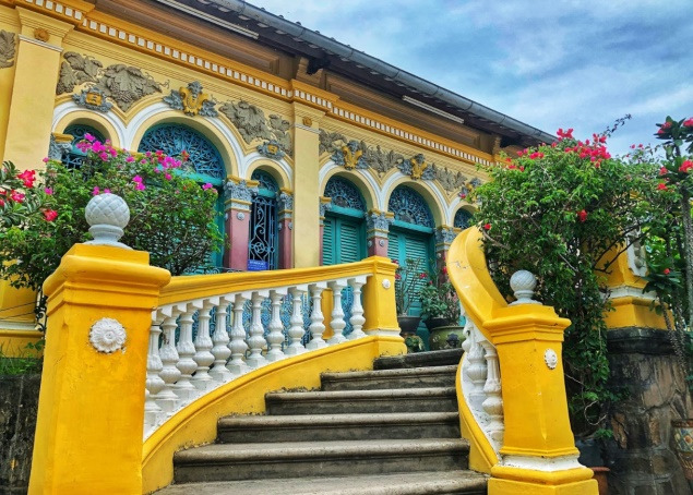
Binh Thuy Ancient House
Binh Thuy Ancient House, nestled amidst the verdant surroundings of Binh Thuy District, is located approximately 5 kilometers southeast of Can Tho City center. This architectural gem, dating back to 1870, showcases exquisite French colonial design and is surrounded by lush gardens adorned with towering trees and vibrant flowers. Steeped in history and heritage, the ancient house offers visitors a glimpse into the region’s rich cultural tapestry, with its well-preserved interior furnishings and captivating stories of generations past.
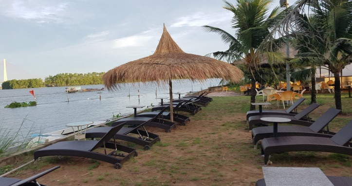
Can Tho Artificial Beach
Can Tho Beach, about 8 kilometers from the city center in the Cai Rang District, provides a refreshing escape with its sandy shores and vibrant ambiance. Visitors can enjoy water sports and leisurely strolls while taking in views of the Can Tho Bridge
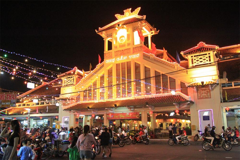
Tay Do Night Market
Tay Do Night Market, nestled along the banks of the Hau River, is located approximately 1 kilometer west of Can Tho City center. This bustling market comes alive at night, offering a vibrant array of dining, shopping, and entertainment options. Visitors can sample an eclectic mix of local delicacies, browse through stalls selling souvenirs and handicrafts, and soak up the lively atmosphere of this nocturnal bazaar. With its dynamic energy and diverse offerings, Tay Do Night Market promises an unforgettable evening for visitors seeking to immerse themselves in the local culture and cuisine.
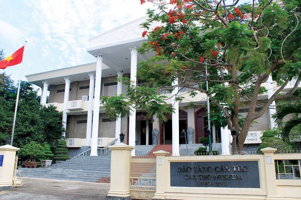
Can Tho Museum
Can Tho Museum, centrally located at 1 Hoa Binh Boulevard in Ninh Kieu District, is a treasure trove of historical artifacts and cultural relics. Spanning a vast area, the museum showcases the rich heritage and heritage of Can Tho and the Mekong Delta region across various historical periods. Visitors can explore immersive exhibitions that delve into the area’s diverse cultural traditions, economic activities, and social dynamics, offering valuable insights into the region’s past, present, and future.


Để lại một bình luận